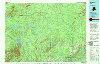
1994 Map of Oakfield
USGS Topo · Published 1994About this map
Oxbow Plantation and Moro Plantation highlight the distinct township-based land organization of the North Woods in the 1990s. This survey records a landscape defined by its complex hydrology and timber heritage, where the Bangor and Aroostook RR connects the riverside settlements of Smyrna Mills and Island Falls. The terrain is dominated by significant elevations such as Mount Chase and The Traveler, which overlook a vast network of water bodies including Millinocket Lake and Grand Lake. The southeastern corner shows the concentrated development near Oakfield, while much of the quadrangle remains dominated by the peaks of the Cunningham Mountains and the northern reaches of Baxter State Park. Researchers will find a detailed view of the transitional infrastructure between the wilder Piscataquis and Penobscot counties and the settled valley along 95.
Find a feature on this map
72 named features on this map. Tap any name to fly to it.
Don’t see what you’re looking for? This feature index may not catch every label — zoom into the map to look around manually.
Map Details
Editions of this 1994 Oakfield Map
This is the sole edition of this map. No revisions or reprints were ever made.
Other maps of this area

1927 · Katahdin
USGS Topo · 1:48,000

1930 · Katahdin
USGS Topo · 1:62,500

1930 · Greenlaw
USGS Topo · 1:48,000

1931 · Ashland
USGS Topo · 1:48,000

1931 · Mooseleuk Lake
USGS Topo · 1:48,000

1932 · Musquacook Lakes
USGS Topo · 1:48,000

1933 · Greenlaw
USGS Topo · 1:62,500

1934 · Bridgewater
USGS Topo · 1:48,000

1934 · Ashland
USGS Topo · 1:62,500

1935 · Musquacook Lakes
USGS Topo · 1:62,500