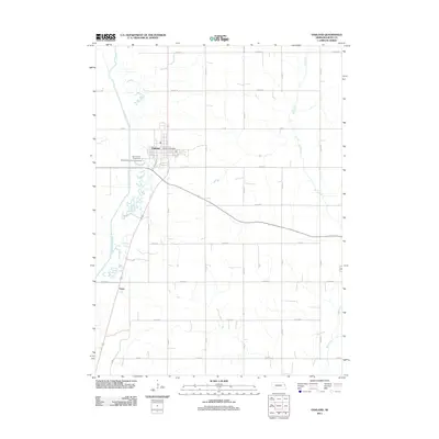
2011 Map of Oakland
USGS Topo · Published 2011About this map
Oakland serves as the primary hub of this eastern Nebraska landscape, situated near the western edge of the quadrangle. The town's civic character is defined by the Oakland Post Office and the Burt County Fairground, while the Oakland City Park Campground provides recreational space along the periphery. The surrounding terrain is dominated by a grid of agricultural section roads, such as Co Road N and Co Road F, which connect smaller locales like Essen.
Find a feature on this map
26 named features on this map. Tap any name to fly to it.
Don’t see what you’re looking for? This feature index may not catch every label — zoom into the map to look around manually.
Map Details
Editions of this 2011 Oakland Map
This is the sole edition of this map. No revisions or reprints were ever made.
Other maps of this area

1955 · Fremont
USGS Topo · 1:250,000

1957 · Fremont
USGS Topo · 1:250,000

1958 · Fremont
USGS Topo · 1:250,000

1966 · Oakland
USGS Topo · 1:24,000

1966 · West Point SE
USGS Topo · 1:24,000

1966 · Uehling
USGS Topo · 1:24,000

1966 · Lyons
USGS Topo · 1:24,000

1966 · West Point NE
USGS Topo · 1:24,000

1966 · Nickerson NW
USGS Topo · 1:24,000

1970 · Oakland SE
USGS Topo · 1:24,000