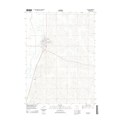
2014 Map of Oakland
USGS Topo · Published 2014About this map
Oakland sits as the primary hub in this corner of Burt County, where the street grid is clearly defined by routes like N Logan Ave and W Fulton St. The landscape is dominated by the complex hydrology of the Logan Creek valley, showing both the straightened Logan Creek Dredge and the winding remnants of the Old Channel Logan Creek. This juxtaposition illustrates decades of water management and drainage efforts intended to reclaim the fertile bottomlands for agriculture. To the south, the small settlement of Essen appears along the highway corridor, while the eastern portion of the map is defined by the repetitive drainages of Bell Cr and Peterson Cr cutting through the upland terrain. The local infrastructure is meticulously detailed, from the primary corridor of Us-77 to the extensive network of county roads that organize the rural landscape into a precise agricultural grid.
Find a feature on this map
29 named features on this map. Tap any name to fly to it.
Don’t see what you’re looking for? This feature index may not catch every label — zoom into the map to look around manually.
Map Details
Editions of this 2014 Oakland Map
This is the sole edition of this map. No revisions or reprints were ever made.
Other maps of this area

1955 · Fremont
USGS Topo · 1:250,000

1957 · Fremont
USGS Topo · 1:250,000

1958 · Fremont
USGS Topo · 1:250,000

1966 · Oakland
USGS Topo · 1:24,000

1966 · West Point SE
USGS Topo · 1:24,000

1966 · Uehling
USGS Topo · 1:24,000

1966 · Lyons
USGS Topo · 1:24,000

1966 · West Point NE
USGS Topo · 1:24,000

1966 · Nickerson NW
USGS Topo · 1:24,000

1970 · Oakland SE
USGS Topo · 1:24,000