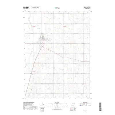
2017 Map of Oakland
USGS Topo · Published 2017About this map
Oakland serves as the primary hub of this Burt County landscape, where the rectilinear grid of city streets like W Fulton St and N Oakland Ave meets the surrounding agricultural terrain. The waterway system is particularly distinctive, featuring the engineered path of the Logan Creek Dredge alongside the winding remnants of the Old Channel Logan Cr. This juxtaposition of the natural wandering creek bed and the straight-line drainage project illustrates the long-standing efforts to manage the fertile bottomlands of eastern Nebraska. To the south, the small settlement of Essen sits near the intersection of country roads, while the drainages of Peterson Cr and Bell Cr carve subtle valleys through the township. The map provides a clear record of local property boundaries and the network of county roads, such as Co Rd L and Co Rd I, that define the region's rural character.
Find a feature on this map
31 named features on this map. Tap any name to fly to it.
Don’t see what you’re looking for? This feature index may not catch every label — zoom into the map to look around manually.
Map Details
Editions of this 2017 Oakland Map
This is the sole edition of this map. No revisions or reprints were ever made.
Other maps of this area

1955 · Fremont
USGS Topo · 1:250,000

1957 · Fremont
USGS Topo · 1:250,000

1958 · Fremont
USGS Topo · 1:250,000

1966 · Oakland
USGS Topo · 1:24,000

1966 · West Point SE
USGS Topo · 1:24,000

1966 · Uehling
USGS Topo · 1:24,000

1966 · Lyons
USGS Topo · 1:24,000

1966 · West Point NE
USGS Topo · 1:24,000

1966 · Nickerson NW
USGS Topo · 1:24,000

1970 · Oakland SE
USGS Topo · 1:24,000