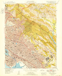
1949 Map of Oakland East
USGS Topo · Published 1949About this map
The hills of the East Bay rise sharply from the urbanized flats of Oakland and Berkeley toward the ridges of the Berkeley Hills. This era finds the region in a state of rapid post-war expansion, with dense residential street grids pushing against the boundaries of Tilden Regional Park and Redwood Regional Park. Notable institutional anchors include the University of California campus in the northwest and Mills College further south.
Find a feature on this map
163 named features on this map. Tap any name to fly to it.
Don’t see what you’re looking for? This feature index may not catch every label — zoom into the map to look around manually.
Map Details
Editions of this 1949 Oakland East Map
2 editions found
Other maps of this area

1892 · San Mateo
USGS Topo · 1:62,500

1895 · San Francisco
USGS Topo · 1:62,500

1896 · San Mateo
USGS Topo · 1:62,500

1897 · Concord
USGS Topo · 1:62,500

1899 · San Francisco
USGS Topo · 1:62,500

1899 · Haywards
USGS Topo · 1:62,500

1899 · San Mateo
USGS Topo · 1:62,500

1915 · San Mateo
USGS Topo · 1:62,500

1915 · Haywards
USGS Topo · 1:62,500

1915 · Concord
USGS Topo · 1:62,500