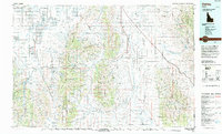
1993 Map of Oakley
USGS Topo · Published 1993About this map
City of Rocks National Reserve anchor the southern portion of this landscape, where granite spires rise from the high desert terrain. The map documents a complex network of ranching settlements and water management systems, including the Lower Goose Creek Reservoir and the irrigation channels of the Raft River Valley. This 1993 edition, compiled from earlier surveys, preserves the locations of several vanished hubs like Churchill (Site) and Moulton (Site), as well as the Hudspeth Cutoff Historical Marker denoting the path of emigrant trails. The geography is defined by parallel north-south ranges, including the Albion Mountains and Black Pine Mountains, which separate the agricultural basins of Oakley and Malta. An Old Railroad Grade remains visible, tracing the legacy of earlier transportation infrastructure through the rugged interior of Cassia County.
Find a feature on this map
45 named features on this map. Tap any name to fly to it.
Don’t see what you’re looking for? This feature index may not catch every label — zoom into the map to look around manually.
Map Details
Editions of this 1993 Oakley Map
This is the sole edition of this map. No revisions or reprints were ever made.
Other maps of this area

1934 · Rockland
USGS Topo · 1:62,500

1937 · Rockland
USGS Topo · 1:62,500

1954 · Pocatello
USGS Topo · 1:250,000

1954 · Brigham City
USGS Topo · 1:250,000

1955 · Twin Falls
USGS Topo · 1:250,000

1955 · Wells
USGS Topo · 1:250,000

1958 · Wells
USGS Topo · 1:250,000

1958 · Twin Falls
USGS Topo · 1:250,000

1958 · Pocatello
USGS Topo · 1:250,000

1958 · Brigham City
USGS Topo · 1:250,000