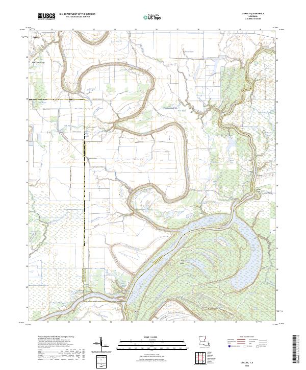
2024 Map of Oakley
USGS Topo · Published 2024About this map
Oakley sits at the northern edge of a landscape defined by the winding course of the Bayou Macon and the Tensas River. This area of Franklin and Tensas parishes is a mosaic of bottomlands and waterways, characterized by unique geographic features such as Big Hog Glade and Little Hog Glade. The map reveals a complex drainage network including Lightning Bayou, Roaring Bayou, and the Deer Creek Cutoff, reflecting the hydrological management of the Mississippi River delta region. Significant tracts of land, such as the Farm Service Agency Interest of Louisiana, highlight the importance of agricultural conservation in this fertile alluvial plain. To the east, the meandering river creates oxbow features like Horseshoe Lake and Moon Lake, indicating the historical shifts of these heavy waterways over time.
Find a feature on this map
61 named features on this map. Tap any name to fly to it.
Don’t see what you’re looking for? This feature index may not catch every label — zoom into the map to look around manually.
Map Details
Editions of this 2024 Oakley Map
This is the sole edition of this map. No revisions or reprints were ever made.
Other maps of this area

1935 · Winnsboro
USGS Topo · 1:62,500

1935 · Shackleford Lake
USGS Topo · 1:62,500

1939 · Locust Ridge
USGS Topo · 1:62,500

1941 · Sicily Island
USGS Topo · 1:62,500

1953 · Natchez
USGS Topo · 1:250,000

1955 · Jackson
USGS Topo · 1:250,000

1956 · Natchez
USGS Topo · 1:250,000

1957 · Sicily Island
USGS Topo · 1:62,500

1958 · Shackleford Lake
USGS Topo · 1:62,500

1958 · Winnsboro
USGS Topo · 1:62,500