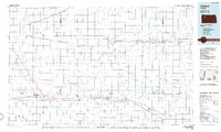
1985 Map of Oakley
USGS Topo · Published 1985About this map
Oakley serves as the focal point for this survey of the High Plains, where the Union Pacific railroad and the Kyle line trace the primary east-west corridors. This 1985 planimetric study reveals the organized grid of Western Kansas, dotted with agricultural settlements like Hoxie, Quinter, and Grainfield. The landscape is defined by the drainage basins of the Saline River and the South Fork Solomon River, with many seasonal draws and creeks carving through the terrain.
Find a feature on this map
80 named features on this map. Tap any name to fly to it.
Don’t see what you’re looking for? This feature index may not catch every label — zoom into the map to look around manually.
Map Details
Editions of this 1985 Oakley Map
2 editions found
Other maps of this area

1893 · Ellis
USGS Topo · 1:125,000

1893 · Norton
USGS Topo · 1:125,000

1893 · Hill
USGS Topo · 1:125,000

1943 · Colby
USGS Topo · 1:62,500

1951 · Selden
USGS Topo · 1:62,500

1951 · Achilles
USGS Topo · 1:62,500

1951 · Chardon
USGS Topo · 1:62,500

1954 · Goodland
USGS Topo · 1:250,000

1955 · Great Bend
USGS Topo · 1:250,000

1955 · Scott City
USGS Topo · 1:250,000