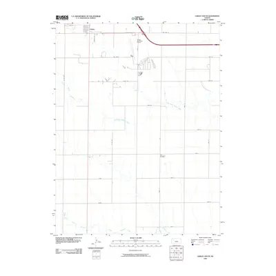
2009 Map of Oakley South
USGS Topo · Published 2009About this map
Oakley marks the northern edge of this Logan County landscape, where the town grid gives way to the vast agricultural expanses of the High Plains. The terrain is defined by the winding drainages of the North Branch Hackberry Creek and Middle Branch Hackberry Creek, which cut subtle paths through the section lines. This 2009 survey highlights a rural infrastructure that blends traditional farming names with modern developments, including the Oakley Municipal Airport and a network of county roads like Co RD 450. For those tracing local heritage, the Zion Norwegian Cemetery stands as a significant landmark of the region's cultural settlement. The map also records unique local road names such as Day Dream and Eagle Eye, alongside the historic corridor of Old Hwy 40.
Find a feature on this map
28 named features on this map. Tap any name to fly to it.
Don’t see what you’re looking for? This feature index may not catch every label — zoom into the map to look around manually.
Map Details
Editions of this 2009 Oakley South Map
This is the sole edition of this map. No revisions or reprints were ever made.
Other maps of this area

1954 · Goodland
USGS Topo · 1:250,000

1955 · Scott City
USGS Topo · 1:250,000

1956 · Goodland
USGS Topo · 1:250,000

1957 · Goodland
USGS Topo · 1:250,000

1958 · Scott City
USGS Topo · 1:250,000

1972 · Elkader NW
USGS Topo · 1:24,000

1972 · Orion
USGS Topo · 1:24,000

1972 · Elkader NE
USGS Topo · 1:24,000
1979 · Oakley SW
USGS Topo · 1:24,000
1979 · Oakley South
USGS Topo · 1:24,000