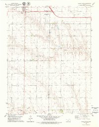
1979 Map of Oakley South
USGS Topo · Published 1979About this map
Oakley serves as the focal point for this High Plains survey, situated where the Union Pacific railroad and major highways converge. The town's northern periphery shows a developed landscape featuring the Oakley Municipal Airport, a Golf Course, and a Roadside Park. Extending southward, the terrain transitions into a productive energy and agricultural zone, marked by an active Oil Field and a large Feedlot near the Logan Co Gove Co line.
Find a feature on this map
20 named features on this map. Tap any name to fly to it.
Don’t see what you’re looking for? This feature index may not catch every label — zoom into the map to look around manually.
Map Details
Editions of this 1979 Oakley South Map
This is the sole edition of this map. No revisions or reprints were ever made.
Other maps of this area

1954 · Goodland
USGS Topo · 1:250,000

1955 · Scott City
USGS Topo · 1:250,000

1956 · Goodland
USGS Topo · 1:250,000

1957 · Goodland
USGS Topo · 1:250,000

1958 · Scott City
USGS Topo · 1:250,000

1972 · Elkader NW
USGS Topo · 1:24,000

1972 · Orion
USGS Topo · 1:24,000

1972 · Elkader NE
USGS Topo · 1:24,000
1979 · Oakley SW
USGS Topo · 1:24,000
1979 · Grinnell South
USGS Topo · 1:24,000