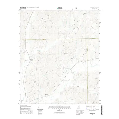
2014 Map of Oakmulgee
USGS Topo · Published 2014About this map
Talladega National Forest encompasses a significant portion of this terrain, where the convergence of Perry, Bibb, and Chilton counties defines the local geography. Small settlements and family landmarks such as Bethlehem and Tabernacle are scattered across a landscape drained by Oakmulgee Creek and its many tributaries, including Beaverdam Creek and Boiling Mill Creek. The area is notably dense with small burial grounds that serve as vital records for local genealogy, including Bethlehem Number 1 Cem, Harris Cemetery, and Legal Cemetery. High points like Bull Mountain and Hicks Hill rise above the winding forest roads, while isolated communities like Pinetucky and Oakmulgee reflect the rural character of this central Alabama region. Modern thoroughfares like State Route 219 and State Route 183 now connect these long-established localities.
Find a feature on this map
46 named features on this map. Tap any name to fly to it.
Don’t see what you’re looking for? This feature index may not catch every label — zoom into the map to look around manually.
Map Details
Editions of this 2014 Oakmulgee Map
This is the sole edition of this map. No revisions or reprints were ever made.
Other maps of this area

1891 · Clanton
USGS Topo · 1:125,000

1953 · Montgomery
USGS Topo · 1:250,000

1956 · Montgomery
USGS Topo · 1:250,000

1957 · Montgomery
USGS Topo · 1:250,000

1959 · Plantersville
USGS Topo · 1:62,500

1959 · Summerfield
USGS Topo · 1:62,500

1971 · Maplesville West
USGS Topo · 1:24,000
1971 · Randolph
USGS Topo · 1:24,000

1979 · Harrisburg
USGS Topo · 1:24,000
1980 · Centreville East
USGS Topo · 1:24,000