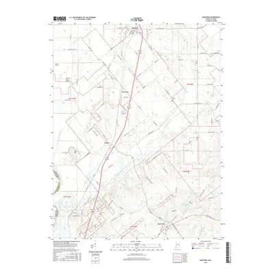
2016 Map of Oaktown
USGS Topo · Published 2016About this map
Shaker Prairie dominates the western landscape of this Knox County region, where a complex network of agricultural drainage including the Shaker Prairie Ditch and Lower Shaker Prairie Ditch has reshaped the land. The settlement pattern follows the high ground and rail corridors, anchored by Oaktown in the north and Bruceville in the south, with the smaller communities of Busseron and Emison situated between them. This 2016 survey captures a rural landscape heavily defined by family and community history, evidenced by numerous small burial grounds such as Ocheltree Cem, Threlkeld Cem, and Light Cem. The terrain transitions from the flat prairie lands near the Wabash River boundary toward the rolling elevations of Wolf Hill. Significant water features like Maria Creek and the Rod and Gun Club Lake provide clear markers of the local hydrology and recreation spots in this part of southwestern Indiana.
Find a feature on this map
105 named features on this map. Tap any name to fly to it.
Don’t see what you’re looking for? This feature index may not catch every label — zoom into the map to look around manually.
Map Details
Editions of this 2016 Oaktown Map
This is the sole edition of this map. No revisions or reprints were ever made.
Other maps of this area

1915 · Vincennes
USGS Topo · 1:62,500

1917 · Birds
USGS Topo · 1:62,500

1942 · Fritchton
USGS Topo · 1:24,000

1942 · Birds
USGS Topo · 1:62,500

1943 · Carlisle
USGS Topo · 1:24,000

1943 · Oaktown
USGS Topo · 1:24,000

1943 · Bicknell
USGS Topo · 1:24,000

1944 · Bucktown
USGS Topo · 1:24,000

1944 · Fritchton
USGS Topo · 1:24,000

1944 · Wheatland
USGS Topo · 1:24,000