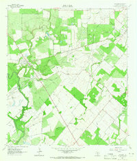
1964 Map of Oakville
USGS Topo · Published 1965About this map
Oakville stands as the primary settlement on this South Texas landscape, positioned near the confluence of Sulphur Creek and the Nueces River. The mid-1960s environment is heavily defined by energy extraction, with extensive networks of Pipelines and numerous drilling sites such as the Harris Oil Field and Oakville-Wilcox Gas Field dominating the terrain. The presence of a dedicated Landing Strip suggests the scale of industrial operations in this period of oil and gas development.
Find a feature on this map
25 named features on this map. Tap any name to fly to it.
Don’t see what you’re looking for? This feature index may not catch every label — zoom into the map to look around manually.
Map Details
Editions of this 1964 Oakville Map
2 editions found
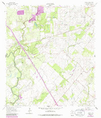
Other maps of this area

1920 · Mikeska
USGS Topo · 1:125,000

1925 · Oakville No. 4
USGS Topo · 1:48,000

1927 · Oakville
USGS Topo · 1:62,500

1936 · Pettus
USGS Topo · 1:62,500

1953 · Crystal City
USGS Topo · 1:250,000

1953 · Beeville
USGS Topo · 1:250,000

1954 · Fleming
USGS Topo · 1:62,500

1955 · Crystal City
USGS Topo · 1:250,000

1956 · Suniland
USGS Topo · 1:62,500

1956 · Beeville
USGS Topo · 1:250,000