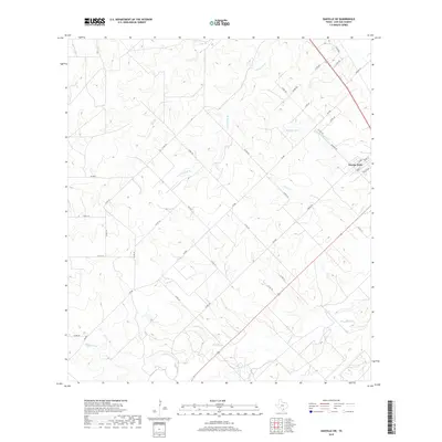
2019 Map of Oakville SW
USGS Topo · Published 2019About this map
George West anchors the northeastern corner of this landscape, where residential streets like Mark St and Houston St meet the ranching roads of Live Oak County. This modern survey illustrates the persistent drainage patterns of the South Texas brush country, defined by intermittent waterways such as Timon Cr and Spring Cr. Central to the area is Katzfey Lake, a notable water body positioned near the junction of FM 889 and Co Rd 441. The terrain is characterized by a dense network of county roads, including Lagarto Rd and Middle Rd, which provide access to the various branches of the regional watershed, including Salt Br and its S Fork Salt Br. This 2019 edition captures the contemporary layout of property boundaries and rural infrastructure outside the main settlement.
Find a feature on this map
43 named features on this map. Tap any name to fly to it.
Don’t see what you’re looking for? This feature index may not catch every label — zoom into the map to look around manually.
Map Details
Editions of this 2019 Oakville SW Map
This is the sole edition of this map. No revisions or reprints were ever made.
Other maps of this area

1920 · Mikeska
USGS Topo · 1:125,000

1925 · Oakville No. 4
USGS Topo · 1:48,000

1925 · Simmons No. 1
USGS Topo · 1:48,000

1927 · Oakville
USGS Topo · 1:62,500

1929 · Simmons
USGS Topo · 1:62,500

1953 · Crystal City
USGS Topo · 1:250,000

1955 · Crystal City
USGS Topo · 1:250,000

1961 · Crystal City
USGS Topo · 1:250,000
1963 · Crater Ridge
USGS Topo · 1:24,000
1963 · Elm Creek
USGS Topo · 1:24,000