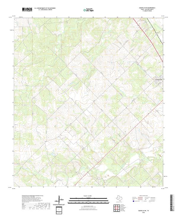
2022 Map of Oakville SW
USGS Topo · Published 2022About this map
George West sits at the northeastern edge of this ranching and brushland landscape, where the town's grid meets the drainage network of the Nueces River valley. The terrain is defined by a dense web of ephemeral waterways including Salt Br, S Fork Salt Br, and Timon Cr, which carve through the low-lying plains. A notable feature in this arid environment is Katzfey Lake, situated near the intersection of several county roads and farm-to-market routes.
Find a feature on this map
40 named features on this map. Tap any name to fly to it.
Don’t see what you’re looking for? This feature index may not catch every label — zoom into the map to look around manually.
Map Details
Editions of this 2022 Oakville SW Map
This is the sole edition of this map. No revisions or reprints were ever made.
Other maps of this area

1920 · Mikeska
USGS Topo · 1:125,000

1925 · Oakville No. 4
USGS Topo · 1:48,000

1925 · Simmons No. 1
USGS Topo · 1:48,000

1927 · Oakville
USGS Topo · 1:62,500

1929 · Simmons
USGS Topo · 1:62,500

1953 · Crystal City
USGS Topo · 1:250,000

1955 · Crystal City
USGS Topo · 1:250,000

1961 · Crystal City
USGS Topo · 1:250,000
1963 · Crater Ridge
USGS Topo · 1:24,000
1963 · Elm Creek
USGS Topo · 1:24,000