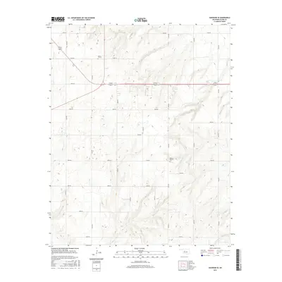
2016 Map of Oakwood SE
USGS Topo · Published 2016About this map
Rising Sun Cem sits at a prominent junction in this section of Blaine County, marking a landscape defined by an orderly grid of section roads and rural drainages. The area is characterized by the headwaters of Weavers Cr and Chicken Cr, which carve subtle relief into the plains. Agricultural activity is central to the terrain, evidenced by the presence of Scott Dam in the northeast. Small, family-named landmarks and local burial grounds like Mount Pleasant Cem provide anchor points for genealogists and local historians tracking the early 21st-century footprint of this Oklahoma interior. The road network, including E0800 Rd and N2470 Rd, illustrates the persistent infrastructure that has supported this ranching and farming community for generations.
Find a feature on this map
25 named features on this map. Tap any name to fly to it.
Don’t see what you’re looking for? This feature index may not catch every label — zoom into the map to look around manually.
Map Details
Editions of this 2016 Oakwood SE Map
This is the sole edition of this map. No revisions or reprints were ever made.
Other maps of this area
1942 · Geary
USGS Topo · 1:62,500
1955 · Clinton
USGS Topo · 1:250,000
1957 · Clinton
USGS Topo · 1:250,000
1964 · Oakwood
USGS Topo · 1:62,500
1964 · Weatherford
USGS Topo · 1:62,500
1972 · Watonga
USGS Topo · 1:24,000
1972 · Watonga Lake
USGS Topo · 1:24,000
1979 · Greenfield
USGS Topo · 1:24,000
1985 · Eagle City
USGS Topo · 1:24,000
1985 · Watonga
USGS Topo · 1:100,000