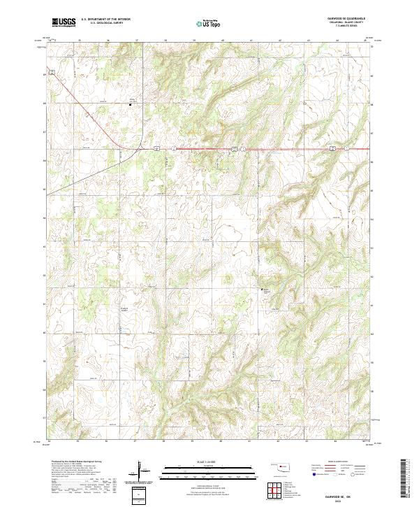
2022 Map of Oakwood SE
USGS Topo · Published 2022About this map
The northern reaches of the Weathers Cr basin in Blaine County reveal a landscape of coordinated section-line roads and family-centered landmarks. Established early in the region's agricultural development, sites like Rising Sun Cem and Mount Pleasant Cem remain critical markers for genealogists and local historians tracking the area's rural population. The topography is defined by the drainages of Weathers Cr and Chicken Cr, while man-made water management is visible at Scott Dam. This 2022 survey also details the Flying D Airport, reflecting the persistence of small-scale aviation alongside traditional ranching and farming operations. The grid of roads, including e0840 RD and n2500 RD, maintains the strict spatial organization first established during the Oklahoma land runs, even as individual homesteads have evolved over the century.
Find a feature on this map
29 named features on this map. Tap any name to fly to it.
Don’t see what you’re looking for? This feature index may not catch every label — zoom into the map to look around manually.
Map Details
Editions of this 2022 Oakwood SE Map
This is the sole edition of this map. No revisions or reprints were ever made.
Other maps of this area

1942 · Geary
USGS Topo · 1:62,500

1955 · Clinton
USGS Topo · 1:250,000

1957 · Clinton
USGS Topo · 1:250,000

1964 · Oakwood
USGS Topo · 1:62,500

1964 · Weatherford
USGS Topo · 1:62,500

1972 · Watonga
USGS Topo · 1:24,000
1972 · Watonga Lake
USGS Topo · 1:24,000

1979 · Greenfield
USGS Topo · 1:24,000
1985 · Eagle City
USGS Topo · 1:24,000
1985 · Watonga
USGS Topo · 1:100,000