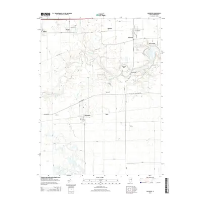
2015 Map of Oakwood
USGS Topo · Published 2015About this map
Oakwood and Fairmount anchor this western Vermilion County landscape, where the meandering course of the Salt Fork river carves a distinct geological path through the prairie. The river creates dramatic features such as the Horseshoe Bend, where the Singing Bridge provides a notable crossing point north of the Bennett area. The settlement pattern follows a clear linear arrangement along historic routes like the Lincoln Trail Rd and railroad corridors, connecting Fithian, Muncie, and Bronson.
Find a feature on this map
34 named features on this map. Tap any name to fly to it.
Don’t see what you’re looking for? This feature index may not catch every label — zoom into the map to look around manually.
Map Details
Editions of this 2015 Oakwood Map
This is the sole edition of this map. No revisions or reprints were ever made.
Other maps of this area

1899 · Danville
USGS Topo · 1:62,500

1900 · Danville
USGS Topo · 1:62,500

1931 · Fithian
USGS Topo · 1:48,000

1943 · Fithian
USGS Topo · 1:62,500

1947 · Ridge Farm
USGS Topo · 1:62,500

1948 · Danville NW
USGS Topo · 1:24,000

1949 · Danville SW
USGS Topo · 1:24,000

1950 · Danville SW
USGS Topo · 1:24,000

1950 · Danville NW
USGS Topo · 1:24,000

1953 · Danville
USGS Topo · 1:250,000