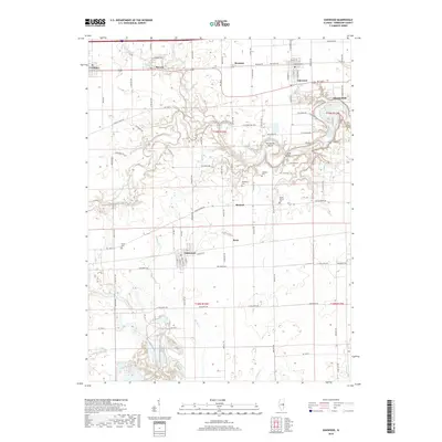
2018 Map of Oakwood
USGS Topo · Published 2018About this map
Oakwood and its neighboring communities in Vermilion County are defined by the winding course of the Salt Fork river, which carves a deep, forested path through the agricultural landscape. The river's path is marked by distinctive natural landmarks like Horseshoe Bend and the Singing Bridge, while nearby Marvin-Fuzey Lake provides a localized water feature south of the main channel. This area maintains a strong connection to its rural past, evidenced by numerous family and community cemeteries such as Davis Cem, Hickman Cem, and Dougherty Cem. The transportation corridor is anchored by the Norfolk Southern railroad, which links the settlements of Fithian, Muncie, and Bronson along its east-west route. In the southeast, the small village of Fairmount sits on the open prairie, highlighting the transition from the river-bottom timber to the expansive fields that dominate the Central Illinois geography.
Find a feature on this map
94 named features on this map. Tap any name to fly to it.
Don’t see what you’re looking for? This feature index may not catch every label — zoom into the map to look around manually.
Map Details
Editions of this 2018 Oakwood Map
This is the sole edition of this map. No revisions or reprints were ever made.
Other maps of this area

1899 · Danville
USGS Topo · 1:62,500

1900 · Danville
USGS Topo · 1:62,500

1931 · Fithian
USGS Topo · 1:48,000

1943 · Fithian
USGS Topo · 1:62,500

1947 · Ridge Farm
USGS Topo · 1:62,500

1948 · Danville NW
USGS Topo · 1:24,000

1949 · Danville SW
USGS Topo · 1:24,000

1950 · Danville SW
USGS Topo · 1:24,000

1950 · Danville NW
USGS Topo · 1:24,000

1953 · Danville
USGS Topo · 1:250,000