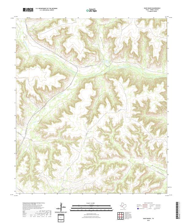
2022 Map of Oasis Ranch
USGS Topo · Published 2022About this map
Independence Cr carves a central path through this section of the Stockton Plateau, serving as the primary hydrological feature in an otherwise arid landscape. The drainage system is defined by deep incisions such as North Canyon and Richland Canyon, where the topography drops sharply toward the creek bed. This 2022 survey illustrates the modern ranching infrastructure of Terrell County, centered around a network of unpaved access points like Cannon Rd and Turk Rd. Isolated water sources such as T 5 Springs remain critical landmarks in this environment, highlighting the continued importance of reliable springs for land management. The road network, including Ranch Rd 1217 and Richland Springs Rd, reflects the low-density settlement patterns and vast land holdings typical of the Trans-Pecos region in the early twenty-first century.
Find a feature on this map
12 named features on this map. Tap any name to fly to it.
Don’t see what you’re looking for? This feature index may not catch every label — zoom into the map to look around manually.
Map Details
Editions of this 2022 Oasis Ranch Map
This is the sole edition of this map. No revisions or reprints were ever made.
Other maps of this area

1929 · Sheffield
USGS Topo · 1:125,000

1954 · Sonora
USGS Topo · 1:250,000

1958 · Sonora
USGS Topo · 1:250,000

1967 · Horsehead Canyon
USGS Topo · 1:24,000

1967 · Sheffield SE
USGS Topo · 1:24,000

1967 · Dead Man Canyon
USGS Topo · 1:24,000

1973 · Post Canyon
USGS Topo · 1:24,000
1973 · Sixshooter Canyon
USGS Topo · 1:24,000
1980 · Geddis Canyon East
USGS Topo · 1:24,000
1980 · Geddis Canyon West
USGS Topo · 1:24,000