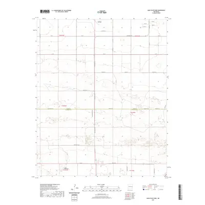
2020 Map of Oasis State Park
USGS Topo · Published 2020About this map
Oasis State Park and the southern edge of Cannon Air Force Base define this High Plains landscape along the border of Curry and Roosevelt Counties. The 2020 terrain is marked by a strict grid of section lines and country roads, including Curry Road 7 and Baseline Rd, which navigate the subtle depressions and sand dunes characteristic of the region. This survey illustrates the transition from the structured military installation in the north to the more varied topography of the state park in the south.
Find a feature on this map
28 named features on this map. Tap any name to fly to it.
Don’t see what you’re looking for? This feature index may not catch every label — zoom into the map to look around manually.
Map Details
Editions of this 2020 Oasis State Park Map
This is the sole edition of this map. No revisions or reprints were ever made.
Other maps of this area

1954 · Clovis
USGS Topo · 1:250,000

1957 · Portair
USGS Topo · 1:62,500

1957 · Clovis
USGS Topo · 1:62,500

1957 · Arch
USGS Topo · 1:62,500

1957 · Portales
USGS Topo · 1:62,500

1958 · Clovis
USGS Topo · 1:250,000

1985 · Portair
USGS Topo · 1:24,000

1985 · Midway
USGS Topo · 1:24,000
1985 · Portales
USGS Topo · 1:24,000
1985 · Bethel
USGS Topo · 1:24,000