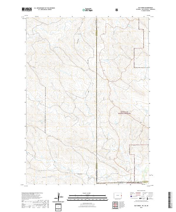
2021 Map of Oat Creek
USGS Topo · Published 2021About this map
The Buffalo Gap National Grassland and Oglala National Grassland meet at a unique tri-state border junction on this survey, where the rangelands of Niobrara County, Wyoming, Fall River County, South Dakota, and Sioux County, Nebraska, converge. This sparsely populated prairie landscape is defined by an intricate network of seasonal drainages and draws that carve through the high plains. The water systems are divided between systems like Middle Fork Alkali Cr and S Fork Alkali Cr in the northeast, and the southern reaches of Oat Creek and Eagle Draw. Aside from the presence of Boner Rd in the Wyoming portion, the map reveals a terrain primarily dedicated to public grazing lands and open range, offering a clear view of the complex legal and geographic boundaries that define the American West's high plains borderlands.
Find a feature on this map
21 named features on this map. Tap any name to fly to it.
Don’t see what you’re looking for? This feature index may not catch every label — zoom into the map to look around manually.
Map Details
Editions of this 2021 Oat Creek Map
This is the sole edition of this map. No revisions or reprints were ever made.
Other maps of this area

1902 · Edgemont
USGS Topo · 1:125,000

1954 · Torrington
USGS Topo · 1:250,000

1955 · Hot Springs
USGS Topo · 1:250,000

1955 · Newcastle
USGS Topo · 1:250,000

1955 · Alliance
USGS Topo · 1:250,000

1957 · Alliance
USGS Topo · 1:250,000

1958 · Torrington
USGS Topo · 1:250,000

1958 · Alliance
USGS Topo · 1:250,000

1958 · Newcastle
USGS Topo · 1:250,000

1978 · Shepherds Point
USGS Topo · 1:24,000