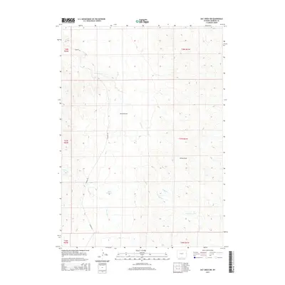
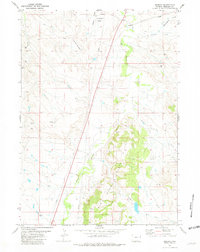
2015 Map of Oat Creek NW
USGS Topo · Published 2015About this map
Boner Reservoir serves as a central water source in this high plains landscape, situated within a drainage network defined by Antelope Cr and Black Tail Cr. The terrain is characterized by long erosional features such as Kincaid Draw and Eldrige Draw, which channel seasonal runoff toward the southern watercourses of Alkali Cr and N Cottonwood Cr. This survey illustrates the low-density infrastructure of Niobrara County, where Cummings Rd provides one of the few primary access routes across the section lines. The map reveals the classic western township and range grid, documenting the relationship between livestock water management and the expansive grazing lands of the Wyoming interior during the early 21st century.
Find a feature on this map
14 named features on this map. Tap any name to fly to it.
Don’t see what you’re looking for? This feature index may not catch every label — zoom into the map to look around manually.
Map Details
Editions of this 2015 Oat Creek NW Map
This is the sole edition of this map. No revisions or reprints were ever made.
Other maps of this area

1955 · Newcastle
USGS Topo · 1:250,000

1958 · Newcastle
USGS Topo · 1:250,000
1978 · Mule Creek
USGS Topo · 1:24,000
1978 · Coffee Flats
USGS Topo · 1:24,000
1978 · Oat Creek NW
USGS Topo · 1:24,000
1978 · South Oat Creek
USGS Topo · 1:24,000
1978 · Oat Creek
USGS Topo · 1:24,000
1978 · Mule Creek SE
USGS Topo · 1:24,000
1981 · Coyote Gap
USGS Topo · 1:24,000
1981 · Redbird
USGS Topo · 1:24,000