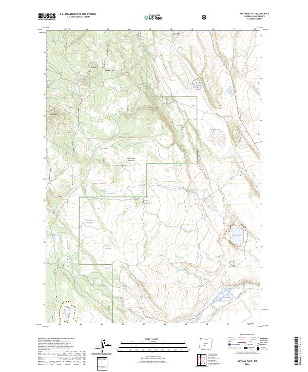
2024 Map of Oatman Flat
USGS Topo · Published 2024About this map
Fremont National Forest dominates this high-altitude landscape in Lake County, where seasonal water management and rugged terrain define the local geography. The map reveals an intricate network of water resources essential to the region, including Shumacher Reservoir Number Five, Round Reservoir, and the distinctive Devils Ball Diamond. These features, alongside Logger Waterhole and Meadow Waterhole, illustrate a history of land use centered on supporting livestock and wildlife in a high-desert environment.
Find a feature on this map
27 named features on this map. Tap any name to fly to it.
Don’t see what you’re looking for? This feature index may not catch every label — zoom into the map to look around manually.
Map Details
Editions of this 2024 Oatman Flat Map
This is the sole edition of this map. No revisions or reprints were ever made.
Other maps of this area

1955 · Crescent
USGS Topo · 1:250,000

1957 · Crescent
USGS Topo · 1:250,000

1958 · Crescent
USGS Topo · 1:250,000

1968 · Silver Lake
USGS Topo · 1:24,000

1968 · Rodman Rock
USGS Topo · 1:24,000

1968 · Oatman Flat
USGS Topo · 1:24,000
1968 · Hager Mtn
USGS Topo · 1:24,000
1968 · Antelope Mtn
USGS Topo · 1:24,000
1968 · Bridge Creek Draw
USGS Topo · 1:24,000

1970 · Crescent
USGS Topo · 1:250,000