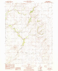
1983 Map of Obed
USGS Topo · Published 1983About this map
The boundary between Macon and Shelby County anchors this central Illinois survey, which details a rural landscape structured by the slow curves of the Flat Branch and Lake Fork. The small settlement of Obed sits near the eastern edge of the quadrangle, while Yantisville occupies the southeastern corner. This area is characterized by a dense distribution of community landmarks, particularly country churches and family burial grounds that reflect generations of local settlement.
Find a feature on this map
23 named features on this map. Tap any name to fly to it.
Don’t see what you’re looking for? This feature index may not catch every label — zoom into the map to look around manually.
Map Details
Editions of this 1983 Obed Map
This is the sole edition of this map. No revisions or reprints were ever made.
Other maps of this area

1942 · Shelbyville
USGS Topo · 1:62,500

1946 · Shelbyville
USGS Topo · 1:62,500

1947 · Pana
USGS Topo · 1:62,500

1949 · Dalton City
USGS Topo · 1:62,500

1949 · Pana
USGS Topo · 1:62,500

1952 · Assumption
USGS Topo · 1:62,500

1958 · Decatur
USGS Topo · 1:250,000

1961 · Decatur
USGS Topo · 1:250,000
1981 · Shelbyville
USGS Topo · 1:24,000
1981 · Tower Hill
USGS Topo · 1:24,000