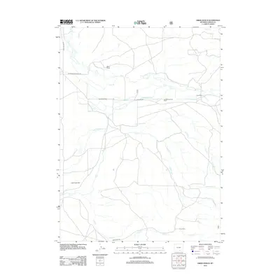
2012 Map of Oberg Ranch
USGS Topo · Published 2012About this map
Oberg Ranch and Moore Ranch anchor this Carbon County landscape, illustrating the enduring agricultural patterns of the high Wyoming plains. The territory is defined by an intricate network of irrigation engineering, with numerous waterways such as Swan Ditch, Nickel Scribner Ditch, and the Ault Highline Ditch diverting water from natural flows like Pass Cr and Lake Cr. These ditches reflect the intensive effort required to cultivate and ranch on the Overland Flats and Lake Creek Flats. Near the center of the sheet, the Standard Pass Creek School stands as a localized landmark along Pass Creek Rd. The presence of the Stock Driveway Rd further emphasizes the historical and continued importance of livestock movement through this area, while natural features like Sand Draw and Hat Cr break up the level terrain.
Find a feature on this map
28 named features on this map. Tap any name to fly to it.
Don’t see what you’re looking for? This feature index may not catch every label — zoom into the map to look around manually.
Map Details
Editions of this 2012 Oberg Ranch Map
This is the sole edition of this map. No revisions or reprints were ever made.
Other maps of this area

1893 · Fort Steele
USGS Topo · 1:125,000

1939 · Saratoga
USGS Topo · 1:125,000

1954 · Rawlins
USGS Topo · 1:250,000

1955 · Overland
USGS Topo · 1:24,000

1955 · Coal Bank Basin
USGS Topo · 1:24,000

1955 · Oberg Ranch
USGS Topo · 1:24,000

1955 · Meads
USGS Topo · 1:24,000

1955 · Rattlesnake Pass
USGS Topo · 1:24,000

1955 · Coad Mountain
USGS Topo · 1:24,000

1958 · Rawlins
USGS Topo · 1:250,000