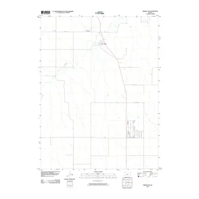
2009 Map of Oberlin NE
USGS Topo · Published 2009About this map
Cedar Bluffs and its surrounding agricultural landscape dominate this Decatur County survey, showing the rural character of the High Plains in the early 21st century. The settlement sits along the winding course of Beaver Creek, where the terrain begins to break from flat plateau into the drainage systems of Rock Draw. This area is characterized by a precise section-line road network, including routes like Co RD 471 and RD 9 N, which facilitate movement between scattered farmsteads and the local community center. For genealogists, the inclusion of Cedar Bluffs Cemetery north of the townsite provides a specific point of interest for family history research. The map illustrates how local geography and infrastructure like Co RD 5 N have remained largely consistent in this corner of northwest Kansas, serving as a reliable record of modern land use and historical settlement patterns.
Find a feature on this map
9 named features on this map. Tap any name to fly to it.
Don’t see what you’re looking for? This feature index may not catch every label — zoom into the map to look around manually.
Map Details
Editions of this 2009 Oberlin NE Map
This is the sole edition of this map. No revisions or reprints were ever made.
Other maps of this area

1951 · Oberlin
USGS Topo · 1:62,500

1951 · Kanona
USGS Topo · 1:62,500

1954 · McCook
USGS Topo · 1:250,000

1954 · Goodland
USGS Topo · 1:250,000

1956 · Goodland
USGS Topo · 1:250,000

1957 · McCook
USGS Topo · 1:250,000

1957 · Goodland
USGS Topo · 1:250,000

1957 · McCook SW
USGS Topo · 1:24,000

1957 · Danbury
USGS Topo · 1:24,000

1957 · McCook SE
USGS Topo · 1:24,000