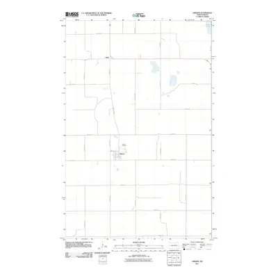
2011 Map of Oberon
USGS Topo · Published 2011About this map
The town of Oberon serves as the focal point for this Benson County prairie landscape, situated near the northern edge of the Crow Hill District. The settlement pattern here reflects the rigid grid of the Public Land Survey System, with gravel and paved routes like County Rd 0329 and 36th St NE dividing the land into vast sections. Just north of the town center lies Hillside Cemetery, a significant landmark for those tracing family history in the region. Further north, the tiny settlement of Lallie sits along the road network near a corner of Devils Lake, which makes a brief appearance in the northeast quadrant. The map reveals the street-level geography of Oberon's core, including North Ave and Carson St S, providing a detailed look at the infrastructure of this rural community in the early twenty-first century.
Find a feature on this map
25 named features on this map. Tap any name to fly to it.
Don’t see what you’re looking for? This feature index may not catch every label — zoom into the map to look around manually.
Map Details
Editions of this 2011 Oberon Map
This is the sole edition of this map. No revisions or reprints were ever made.
Other maps of this area

1931 · Oberon
USGS Topo · 1:62,500

1932 · Flora
USGS Topo · 1:62,500

1932 · Grahams Island
USGS Topo · 1:62,500

1950 · Oberon SW
USGS Topo · 1:24,000

1950 · Sheyenne
USGS Topo · 1:24,000

1950 · Grahams Island
USGS Topo · 1:62,500

1950 · Oberon
USGS Topo · 1:62,500

1951 · Crow Hill
USGS Topo · 1:24,000

1951 · Oberon
USGS Topo · 1:24,000

1951 · Flora SE
USGS Topo · 1:24,000