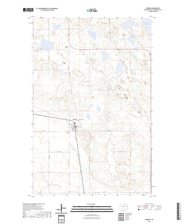
2024 Map of Oberon
USGS Topo · Published 2024About this map
Oberon stands as a central point of settlement on this Benson County landscape, where the local street grid is defined by Main Ave, Martin St, and Carson St. The community is anchored by essential services like the Po and the nearby Hillside Cem, which provides significant local genealogical value. North of the town center, the terrain is shaped by the extensive Benson County Waterfowl Production Area, a series of protected wetlands and basins characteristic of the region’s prairie pothole geography. The small settlement of Lallie sits further north along the road network, while the northeastern corner of the map captures the western reaches of Devils Lake. The grid of township and range lines, such as t152n r67w, organizes a landscape of scattered sloughs and section roads that reflect the enduring agricultural and conservation-focused character of central North Dakota.
Find a feature on this map
30 named features on this map. Tap any name to fly to it.
Don’t see what you’re looking for? This feature index may not catch every label — zoom into the map to look around manually.
Map Details
Editions of this 2024 Oberon Map
This is the sole edition of this map. No revisions or reprints were ever made.
Other maps of this area

1931 · Oberon
USGS Topo · 1:62,500

1932 · Flora
USGS Topo · 1:62,500

1932 · Grahams Island
USGS Topo · 1:62,500

1950 · Oberon SW
USGS Topo · 1:24,000

1950 · Sheyenne
USGS Topo · 1:24,000

1950 · Grahams Island
USGS Topo · 1:62,500

1950 · Oberon
USGS Topo · 1:62,500

1951 · Crow Hill
USGS Topo · 1:24,000

1951 · Oberon
USGS Topo · 1:24,000

1951 · Flora SE
USGS Topo · 1:24,000