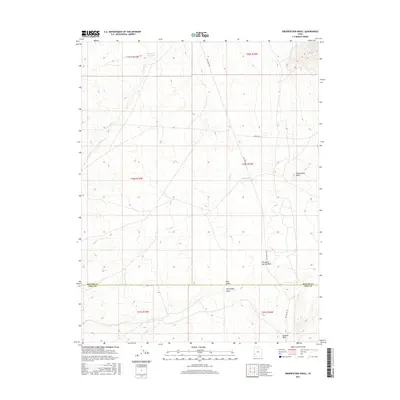
2017 Map of Observation Knoll
USGS Topo · Published 2017About this map
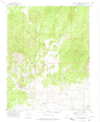
The boundary between Beaver and Iron counties defines the lower third of this high-elevation landscape, where drainage patterns dictate the movement of water across the Great Basin. In the northern reaches, Sheep Cr Reservoir and the headwaters of Sheep Cr collect runoff, while further south, Pinto Cr carves a path through the terrain. The small settlement at Pine Valley sits near the namesake Pine Valley Wash, serving as a focal point for the few roads that traverse the area, including Pine Valley Rd and Jockey Rd. To the east, the prominent Observation Knoll provides a vantage point over the complex system of dry washes like Mountain Spring Wash and Jackson Wash. This 2017 U.S. Geological Survey representation documents the modern hydraulic management of the region, evidenced by the Mackelprang Reservoir and the varied creek systems.
Find a feature on this map
19 named features on this map. Tap any name to fly to it.
Don’t see what you’re looking for? This feature index may not catch every label — zoom into the map to look around manually.
Map Details
Editions of this 2017 Observation Knoll Map
This is the sole edition of this map. No revisions or reprints were ever made.
Other maps of this area

1953 · Richfield
USGS Topo · 1:250,000

1958 · Richfield
USGS Topo · 1:250,000
1971 · Observation Knoll
USGS Topo · 1:24,000
1971 · Pine Grove Reservoir
USGS Topo · 1:24,000
1971 · Pinto Spring
USGS Topo · 1:24,000
1971 · Bible Spring
USGS Topo · 1:24,000
1971 · The Tetons
USGS Topo · 1:24,000
1971 · Lamerdorf Peak
USGS Topo · 1:24,000
1971 · Steamboat Mtn
USGS Topo · 1:24,000
1972 · Mountain Spring Peak
USGS Topo · 1:24,000