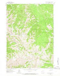
1963 Map of Observation Peak
USGS Topo · Published 1966About this map
Snake River Range peaks and high-altitude drainage systems dominate this mid-century survey of the Wyoming wilderness. The landscape is defined by the boundary between Targhee National Forest and Teton National Forest, where steep ridgelines separate watersheds such as Big Elk Creek and Fall Creek. This period of forest management is characterized by a primitive transportation network, consisting almost entirely of a Pack Trail system and the occasional Jeep Trail, facilitating access to remote landmarks like Observation Peak and Indian Peak. The absence of developed roads highlights the isolation of high-country features such as Lake Basin and Big Basin. Significant topographical points like North Indian Creek Pass and Red Pass mark the few established routes through the serrated terrain of the Teton and Lincoln County border.
Find a feature on this map
24 named features on this map. Tap any name to fly to it.
Don’t see what you’re looking for? This feature index may not catch every label — zoom into the map to look around manually.
Map Details
Editions of this 1963 Observation Peak Map
2 editions found

Other maps of this area

1931 · Jackson
USGS Topo · 1:125,000

1932 · Irwin
USGS Topo · 1:96,000

1935 · Irwin
USGS Topo · 1:125,000

1935 · Jackson
USGS Topo · 1:125,000

1955 · Driggs
USGS Topo · 1:250,000

1958 · Driggs
USGS Topo · 1:250,000

1962 · Driggs
USGS Topo · 1:250,000

1963 · Munger Mountain
USGS Topo · 1:24,000

1963 · Jackson
USGS Topo · 1:24,000

1963 · Teton Pass
USGS Topo · 1:24,000