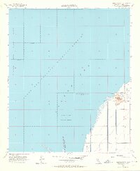
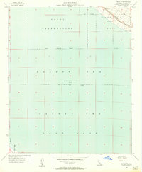
1956 Map of Obsidian Butte
USGS Topo · Published 1964About this map
Salton Sea National Wildlife Refuge dominates this mid-century survey, documenting the expansive shoreline and engineering of the Imperial Valley basin. Recorded during a period when the water level stood at elevation 235 feet below sea level, the map reveals a landscape defined by an intricate network of irrigation and drainage infrastructure including the Estelle Drain, Vail Cut Off Drain, and numerous controlled laterals. The prominent volcanic landform Obsidian Butte stands near the edge of the water, accompanied by a local Quarry and Pumice Rd, indicating active mineral extraction at the time. The southern entry of the New River into the sea and the presence of various Pump stations and levee systems illustrate the ongoing efforts to manage water and salinity in this unique desert depression.
Find a feature on this map
19 named features on this map. Tap any name to fly to it.
Don’t see what you’re looking for? This feature index may not catch every label — zoom into the map to look around manually.
Map Details
Editions of this 1956 Obsidian Butte Map
4 editions found
Other maps of this area

1940 · Kane Spring
USGS Topo · 1:62,500

1940 · Frink
USGS Topo · 1:62,500

1940 · Durmid
USGS Topo · 1:62,500

1944 · Durmid
USGS Topo · 1:62,500

1944 · Kane Spring
USGS Topo · 1:62,500

1944 · Calipatria
USGS Topo · 1:62,500

1944 · Frink
USGS Topo · 1:62,500

1954 · Salton Sea
USGS Topo · 1:250,000

1955 · Salton Sea
USGS Topo · 1:250,000
1956 · Durmid SE
USGS Topo · 1:24,000