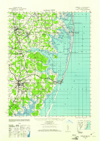
1942 Map of Ocean City
USGS Topo · Published 1961About this map
The coastal barrier landscape of the Delmarva Peninsula is captured here during the early 1940s, a time when Ocean City stood as a concentrated seaside settlement before mid-century expansion. The geography is defined by the complex system of back bays, including Little Assawoman Bay and Isle of Wight Bay, separated from the Atlantic Ocean by thin strips of land. On these reaches, maritime safety is anchored by the Fenwick Island Lighthouse and several Life Saving Stations, such as Fenwick Island LSS and Isle of Wight LSS.
Find a feature on this map
78 named features on this map. Tap any name to fly to it.
Don’t see what you’re looking for? This feature index may not catch every label — zoom into the map to look around manually.
Map Details
Editions of this 1942 Ocean City Map
2 editions found
Other maps of this area

1901 · Snow Hill
USGS Topo · 1:62,500

1901 · Green Run
USGS Topo · 1:62,500

1901 · Ocean City
USGS Topo · 1:62,500

1902 · Pittsville
USGS Topo · 1:62,500

1917 · Millsboro
USGS Topo · 1:62,500

1918 · Rehoboth
USGS Topo · 1:62,500

1938 · Millsboro
USGS Topo · 1:62,500

1938 · Rehoboth
USGS Topo · 1:62,500

1938 · Green Run
USGS Topo · 1:62,500

1942 · Ocean City
USGS Topo · 1:62,500