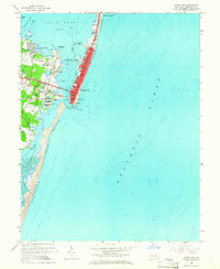
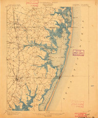
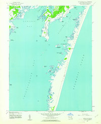
1964 Map of Ocean City
USGS Topo · Published 1966About this map
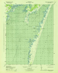
Fenwick Island is depicted during a period of significant mid-century development, showing the transition from the concentrated commercial hub of Ocean City to the expanding residential areas of North Ocean City. The landscape is defined by its relationship to the water, with the Ocean City Inlet separating the bustling resort town from the untouched northern tip of Assateague Island. Infrastructure such as the Ocean City Airport, the Radio Towers (WETT), and the Filtration Plant indicate the growth of municipal services required to support the seasonal and permanent population.
Find a feature on this map
42 named features on this map. Tap any name to fly to it.
Don’t see what you’re looking for? This feature index may not catch every label — zoom into the map to look around manually.
Map Details
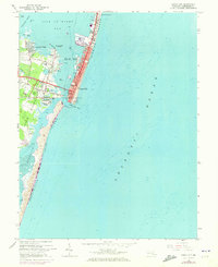
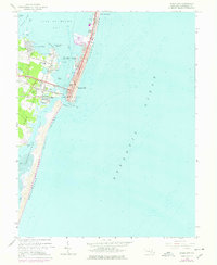
Editions of this 1964 Ocean City Map
3 editions found
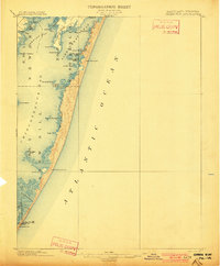
Other maps of this area
1901 · Green Run
USGS Topo · 1:62,500
1901 · Ocean City
USGS Topo · 1:62,500
1938 · Green Run
USGS Topo · 1:62,500
1942 · Ocean City
USGS Topo · 1:62,500
1942 · Ocean City
USGS Topo · 1:24,000
1942 · Tingles Island
USGS Topo · 1:24,000
1943 · Selbyville
USGS Topo · 1:31,680
1943 · Berlin
USGS Topo · 1:31,680
1943 · Ocean City
USGS Topo · 1:31,680
1943 · Tingles Island
USGS Topo · 1:31,680