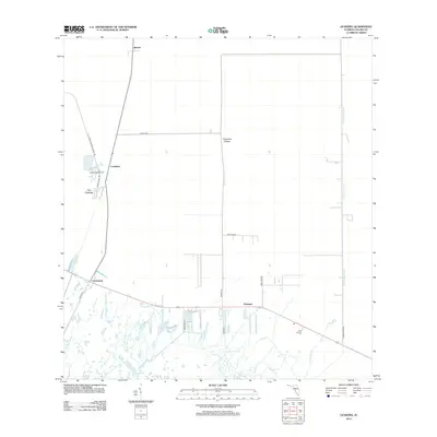
2012 Map of Ochopee
USGS Topo · Published 2012About this map
Ochopee and Carnestown anchor this 2012 survey of the Florida Everglades, documenting a landscape defined by water management and transit corridors. The area’s infrastructure is dominated by the Turner River Canal and the natural flow of the Turner River, which bisect the marshlands and cypress stands. North of the main settlements, the transition from the Lee Cypress tract to the open Copeland Prairie illustrates the varied ecological zones of Collier County.
Find a feature on this map
19 named features on this map. Tap any name to fly to it.
Don’t see what you’re looking for? This feature index may not catch every label — zoom into the map to look around manually.
Map Details
Editions of this 2012 Ochopee Map
This is the sole edition of this map. No revisions or reprints were ever made.
Other maps of this area

1956 · Miami
USGS Topo · 1:250,000

1956 · West Palm Beach
USGS Topo · 1:250,000

1957 · West Palm Beach
USGS Topo · 1:250,000

1958 · West Palm Beach
USGS Topo · 1:250,000

1958 · Miami
USGS Topo · 1:250,000

1959 · Deep Lake
USGS Topo · 1:24,000

1959 · Deep Lake SW
USGS Topo · 1:24,000

1972 · Weavers Station
USGS Topo · 1:24,000

1972 · Burns Lake
USGS Topo · 1:24,000

1972 · Ochopee
USGS Topo · 1:24,000