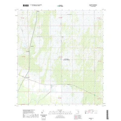
2021 Map of Ochopee
USGS Topo · Published 2021About this map
Big Cypress National Preserve encompasses the majority of this landscape, where a network of water and wetlands defines the human footprint. Small settlements like Jerome, Copeland, and Ochopee are scattered along the major transit corridors of Tamiami Trl E and Co Rd 29. The map shows a transition from the open Copeland Prairie into the dense Deep Lake Strand, illustrating the unique hydrology of southwest Florida.
Find a feature on this map
31 named features on this map. Tap any name to fly to it.
Don’t see what you’re looking for? This feature index may not catch every label — zoom into the map to look around manually.
Map Details
Editions of this 2021 Ochopee Map
This is the sole edition of this map. No revisions or reprints were ever made.
Other maps of this area

1956 · Miami
USGS Topo · 1:250,000

1956 · West Palm Beach
USGS Topo · 1:250,000

1957 · West Palm Beach
USGS Topo · 1:250,000

1958 · West Palm Beach
USGS Topo · 1:250,000

1958 · Miami
USGS Topo · 1:250,000

1959 · Deep Lake
USGS Topo · 1:24,000

1959 · Deep Lake SW
USGS Topo · 1:24,000

1972 · Weavers Station
USGS Topo · 1:24,000

1972 · Burns Lake
USGS Topo · 1:24,000

1972 · Ochopee
USGS Topo · 1:24,000