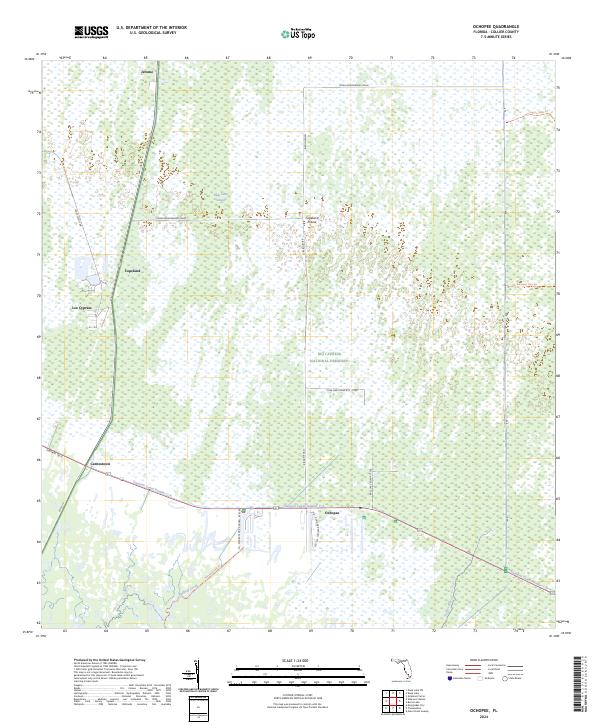
2024 Map of Ochopee
USGS Topo · Published 2024About this map
Ochopee and the surrounding cypress strands define this section of the western Everglades, where the southern wilderness meets the infrastructure of the Tamiami Canal Number C-4. The map documents a landscape of transition, from the small settlements of Jerome and Copeland to the expansive protected reaches of the Big Cypress National Preserve. The hydrology of the region is prominent, shaped by the flow of the Turner River and Halfway Creek, which cut through the low-lying terrain near the southern coast.
Find a feature on this map
34 named features on this map. Tap any name to fly to it.
Don’t see what you’re looking for? This feature index may not catch every label — zoom into the map to look around manually.
Map Details
Editions of this 2024 Ochopee Map
This is the sole edition of this map. No revisions or reprints were ever made.
Other maps of this area

1956 · Miami
USGS Topo · 1:250,000

1956 · West Palm Beach
USGS Topo · 1:250,000

1957 · West Palm Beach
USGS Topo · 1:250,000

1958 · West Palm Beach
USGS Topo · 1:250,000

1958 · Miami
USGS Topo · 1:250,000

1959 · Deep Lake
USGS Topo · 1:24,000

1959 · Deep Lake SW
USGS Topo · 1:24,000

1972 · Weavers Station
USGS Topo · 1:24,000

1972 · Burns Lake
USGS Topo · 1:24,000

1972 · Ochopee
USGS Topo · 1:24,000