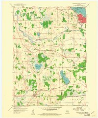
1959 Map of Oconomowoc West
USGS Topo · Published 1961About this map
The Oconomowoc and Concord areas are defined by a complex network of glacial lakes and river systems as they appeared in the late 1950s. The Rock River meanders through the northern townships, while the Oconomowoc River feeds into Lac La Belle near the growing hub of Oconomowoc. This landscape reflects a mix of established agricultural settlements and early suburban expansion, with the Sullivan village anchored to the south by the Chicago and North Western rail line. Local history is deeply embedded in the rural infrastructure, from the Norwegian Cem and Concord Center Cem to various neighborhood schoolhouses like Lakeside Sch and Golden Lake Sch. The presence of large water bodies such as Golden Lake and Goose Lake underscores the region's long-standing character as a destination for both milling and recreation.
Find a feature on this map
36 named features on this map. Tap any name to fly to it.
Don’t see what you’re looking for? This feature index may not catch every label — zoom into the map to look around manually.
Map Details
Editions of this 1959 Oconomowoc West Map
2 editions found
Other maps of this area

1892 · Watertown
USGS Topo · 1:62,500

1892 · Oconomowoc
USGS Topo · 1:62,500

1892 · Whitewater
USGS Topo · 1:62,500

1892 · Eagle
USGS Topo · 1:62,500

1893 · Whitewater
USGS Topo · 1:62,500

1894 · Watertown
USGS Topo · 1:62,500

1894 · Eagle
USGS Topo · 1:62,500

1897 · Eagle
USGS Topo · 1:62,500

1903 · Whitewater
USGS Topo · 1:62,500

1906 · Eagle
USGS Topo · 1:62,500