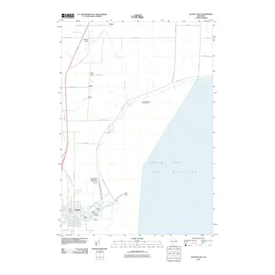
2010 Map of Oconto East
USGS Topo · Published 2010About this map
Oconto serves as the focal point of this coastal study, situated where the Oconto River flows into the vast waters of Green Bay and Lake Michigan. The settlement pattern follows the river's path, with historical infrastructure including the Oconto Post Office, Municipal Wharf, and Newport Marina marking the town's maritime and civic identity. South of the main channel, Ajax Island and the Lindsey Cemetery reflect the local geography of the river mouth, while the Oconto Marsh Wildlife Area and its 3WR350 Dam suggest the conservation and water management efforts north of the town center.
Find a feature on this map
44 named features on this map. Tap any name to fly to it.
Don’t see what you’re looking for? This feature index may not catch every label — zoom into the map to look around manually.
Map Details
Editions of this 2010 Oconto East Map
This is the sole edition of this map. No revisions or reprints were ever made.
Other maps of this area

1939 · Marinette
USGS Topo · 1:48,000

1939 · Porterfield
USGS Topo · 1:48,000

1942 · Porterfield
USGS Topo · 1:48,000

1954 · Escanaba
USGS Topo · 1:250,000

1954 · Manitowoc
USGS Topo · 1:250,000

1956 · Oconto
USGS Topo · 1:62,500

1957 · Escanaba
USGS Topo · 1:250,000

1958 · Escanaba
USGS Topo · 1:250,000

1958 · Manitowoc
USGS Topo · 1:250,000

1961 · Little Sturgeon
USGS Topo · 1:62,500