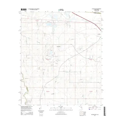
2015 Map of Octahatchee
USGS Topo · Published 2015About this map
Jennings sits at the northeastern corner of this Florida-Georgia borderland, where the landscape is defined by the winding course of the Withlacoochee River and the prominent Lake Octahatchee. The area reflects a mix of traditional rural life and specialized land use, seen in the small settlement of Octahatchee and the nearby Squires Aviation Ranch. This 2015 survey details a dense network of country roads, including Hardee Camp Rd and NW 44th St, which weave through the townships of Hamilton and Madison counties. Genealogists can identify significant local landmarks like Blair Cem and McCall Cem, which are preserved alongside newer infrastructure and state boundaries. The map provides a precise look at the transition from the Georgia state line into the Florida interior, where natural water bodies and established property lines continue to shape the regional character.
Find a feature on this map
50 named features on this map. Tap any name to fly to it.
Don’t see what you’re looking for? This feature index may not catch every label — zoom into the map to look around manually.
Map Details
Editions of this 2015 Octahatchee Map
This is the sole edition of this map. No revisions or reprints were ever made.
Other maps of this area

1954 · Valdosta
USGS Topo · 1:250,000

1956 · Clyattville
USGS Topo · 1:24,000

1956 · Jennings
USGS Topo · 1:24,000

1956 · Octahatchee
USGS Topo · 1:24,000

1958 · Valdosta
USGS Topo · 1:250,000

1958 · Fort Union
USGS Topo · 1:24,000

1958 · Lee
USGS Topo · 1:24,000

1959 · Valdosta
USGS Topo · 1:250,000

1959 · Ellaville
USGS Topo · 1:24,000

1960 · Pinetta
USGS Topo · 1:24,000