
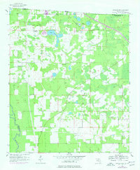
1956 Map of Octahatchee
USGS Topo · Published 1958About this map
The Watson Line and the winding Withlacoochee River define this corner of the Florida-Georgia border during the mid-1950s. The landscape is characterized by a dense network of swamps and intermittent lakes, typical of Hamilton County, with the central Lake Octahatchee and the small settlement of Octahatchee serving as primary landmarks. The presence of the Bellville High Sch near the western edge suggests the community core of the era, while the surrounding piney woods are dotted with small rural landmarks.
Find a feature on this map
15 named features on this map. Tap any name to fly to it.
Don’t see what you’re looking for? This feature index may not catch every label — zoom into the map to look around manually.
Map Details
Editions of this 1956 Octahatchee Map
2 editions found
Other maps of this area

1954 · Valdosta
USGS Topo · 1:250,000

1956 · Clyattville
USGS Topo · 1:24,000

1956 · Jennings
USGS Topo · 1:24,000

1958 · Valdosta
USGS Topo · 1:250,000

1958 · Fort Union
USGS Topo · 1:24,000

1958 · Lee
USGS Topo · 1:24,000

1959 · Valdosta
USGS Topo · 1:250,000

1959 · Ellaville
USGS Topo · 1:24,000

1960 · Pinetta
USGS Topo · 1:24,000

1971 · Lake Park
USGS Topo · 1:24,000