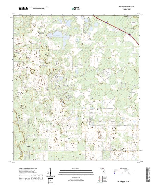
2024 Map of Octahatchee
USGS Topo · Published 2024About this map
Octahatchee and the surrounding borderlands of Hamilton County, Florida, reveal a landscape defined by small-scale aviation, scattered rural cemeteries, and the meandering Withlacoochee River. The topography is marked by numerous karst ponds and wetlands, with Lake Octahatchee serving as a central water feature in the northern portion of the quadrangle. For genealogists and local historians, the abundance of family and community burial grounds, such as Hamilton Cem, McCall Cem, and Wells Cem, provides a detailed look at the settlement patterns of this cross-border region near Georgia. Religious and community life is anchored by sites like the Burnham Church and the New Bethel A M E Memorial Garden. The southern reach of the map features the Squires Aviation Ranch Airport, reflecting the area's continued reliance on local airstrips within the rural North Florida timber and agricultural corridor.
Find a feature on this map
50 named features on this map. Tap any name to fly to it.
Don’t see what you’re looking for? This feature index may not catch every label — zoom into the map to look around manually.
Map Details
Editions of this 2024 Octahatchee Map
This is the sole edition of this map. No revisions or reprints were ever made.
Other maps of this area

1954 · Valdosta
USGS Topo · 1:250,000

1956 · Clyattville
USGS Topo · 1:24,000

1956 · Jennings
USGS Topo · 1:24,000

1956 · Octahatchee
USGS Topo · 1:24,000

1958 · Valdosta
USGS Topo · 1:250,000

1958 · Fort Union
USGS Topo · 1:24,000

1958 · Lee
USGS Topo · 1:24,000

1959 · Valdosta
USGS Topo · 1:250,000

1959 · Ellaville
USGS Topo · 1:24,000

1960 · Pinetta
USGS Topo · 1:24,000