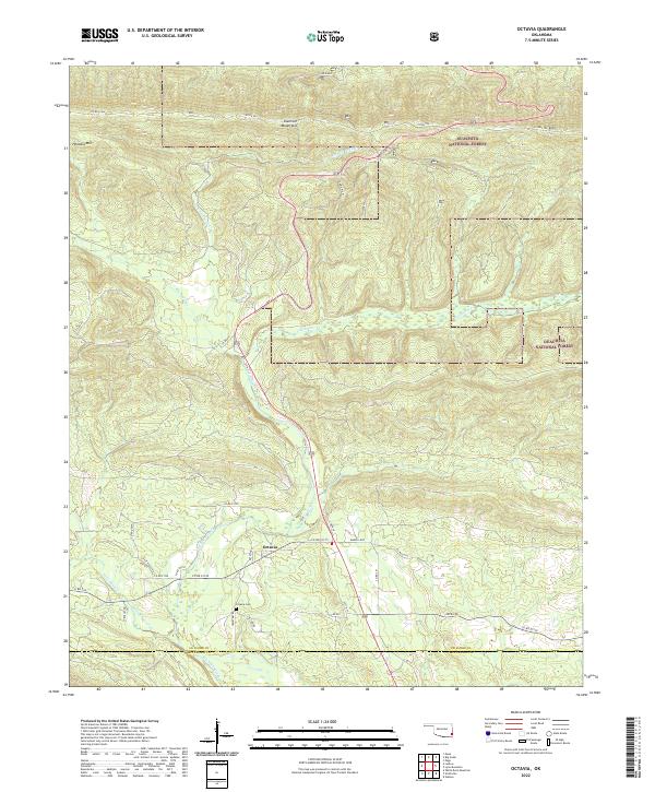
2022 Map of Octavia
USGS Topo · Published 2022About this map
Octavia sits at the intersection of Octavia Rd and Co Rd E1715, serving as a focal point for this rural landscape in the Kiamichi Mountains. The settlement is closely tied to the surrounding Ouachita National Forest, which covers a significant portion of the northern and eastern terrain. Local history is anchored by the Octavia Cem and a network of county roads that follow the winding paths of several watercourses. Big Eagle Creek and Cucumber Cr dominate the central drainage, while the elevations of Honobia Mtn rise to the northwest. The map captures the border between Le Flore and McCurtain counties, showing how the road system, including US Hwy 259, navigates the complex topography of the southern Oklahoma highlands.
Find a feature on this map
43 named features on this map. Tap any name to fly to it.
Don’t see what you’re looking for? This feature index may not catch every label — zoom into the map to look around manually.
Map Details
Editions of this 2022 Octavia Map
This is the sole edition of this map. No revisions or reprints were ever made.
Other maps of this area

1900 · Winding Stair
USGS Topo · 1:125,000

1902 · Lukfata
USGS Topo · 1:125,000

1909 · Winding Stair
USGS Topo · 1:125,000

1950 · Mcalester
USGS Topo · 1:250,000

1959 · Page
USGS Topo · 1:62,500

1960 · Bethel
USGS Topo · 1:62,500

1960 · Smithville
USGS Topo · 1:62,500

1962 · McAlester
USGS Topo · 1:250,000

1965 · McAlester
USGS Topo · 1:250,000
1966 · Muse
USGS Topo · 1:24,000