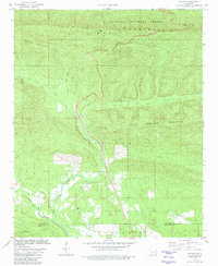
1981 Map of Octavia
USGS Topo · Published 1981About this map
Octavia serves as the focal point of this 1981 survey, positioned at the intersection of mountain peaks and winding waterways in southeastern Oklahoma. The settlement is centered near the Octavia Cem and the Big Eagle Creek valley. Much of the northern landscape is defined by the Kiamichi Mountains and protected within the Ouachita National Forest, where topography is marked by significant elevations like Honobia Mountain. This region demonstrates the transition from higher peaks to the lower drainages of Cucumber Creek and Little Eagle Creek. The boundary between Le Flore Co and McCurtain Co runs through the southern portion of the sheet, near Sulphur Mountain. Evidence of local industry and infrastructure is present in the form of a Gravel Pit and a Radio Tower, which punctuate the timbered terrain and creek-bottom lands.
Find a feature on this map
16 named features on this map. Tap any name to fly to it.
Don’t see what you’re looking for? This feature index may not catch every label — zoom into the map to look around manually.
Map Details
Editions of this 1981 Octavia Map
This is the sole edition of this map. No revisions or reprints were ever made.
Other maps of this area

1900 · Winding Stair
USGS Topo · 1:125,000

1902 · Lukfata
USGS Topo · 1:125,000

1909 · Winding Stair
USGS Topo · 1:125,000

1950 · Mcalester
USGS Topo · 1:250,000

1959 · Page
USGS Topo · 1:62,500

1960 · Bethel
USGS Topo · 1:62,500

1960 · Smithville
USGS Topo · 1:62,500

1962 · McAlester
USGS Topo · 1:250,000

1965 · McAlester
USGS Topo · 1:250,000
1966 · Muse
USGS Topo · 1:24,000