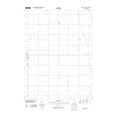
2010 Map of Odebolt East
USGS Topo · Published 2010About this map
Odebolt serves as the primary hub for this stretch of Sac County, anchoring an agricultural landscape defined by a precise grid of section-line roads. The town's western edge is marked by the Odebolt Cemetery, while the surrounding prairie is dotted with smaller burying grounds that hint at early rural congregations and neighborhoods, including Richland Cemetery, Salem Reform Cemetery, and Clinton Center Cemetery.
Find a feature on this map
25 named features on this map. Tap any name to fly to it.
Don’t see what you’re looking for? This feature index may not catch every label — zoom into the map to look around manually.
Map Details
Editions of this 2010 Odebolt East Map
This is the sole edition of this map. No revisions or reprints were ever made.
Other maps of this area

1954 · Fort Dodge
USGS Topo · 1:250,000

1957 · Fort Dodge
USGS Topo · 1:250,000

1958 · Fort Dodge
USGS Topo · 1:250,000

1971 · Kiron
USGS Topo · 1:24,000

1980 · Odebolt East
USGS Topo · 1:24,000

1980 · Early
USGS Topo · 1:24,000

1980 · Lake View
USGS Topo · 1:24,000
1980 · Sac City West
USGS Topo · 1:24,000

1980 · Boyer
USGS Topo · 1:24,000
1980 · Vail NE
USGS Topo · 1:24,000