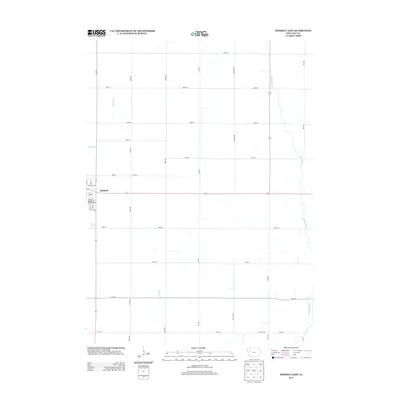
2013 Map of Odebolt East
USGS Topo · Published 2013About this map
Odebolt anchors the western edge of this agricultural landscape in Sac County, serving as the primary hub for the surrounding township. The town is marked by a clear street grid including N Main St, Richland Ave, and E 8th St, while the Odebolt Memorial Walk RV Park sits on the southern edge of the settlement. The surrounding terrain is defined by the gentle drainage patterns of the Boyer River, which meanders through the eastern portion of the quadrangle, and smaller tributaries like Odebolt Cr and Wheeler Cr.
Find a feature on this map
31 named features on this map. Tap any name to fly to it.
Don’t see what you’re looking for? This feature index may not catch every label — zoom into the map to look around manually.
Map Details
Editions of this 2013 Odebolt East Map
This is the sole edition of this map. No revisions or reprints were ever made.
Other maps of this area

1954 · Fort Dodge
USGS Topo · 1:250,000

1957 · Fort Dodge
USGS Topo · 1:250,000

1958 · Fort Dodge
USGS Topo · 1:250,000

1971 · Kiron
USGS Topo · 1:24,000

1980 · Odebolt East
USGS Topo · 1:24,000

1980 · Early
USGS Topo · 1:24,000

1980 · Lake View
USGS Topo · 1:24,000
1980 · Sac City West
USGS Topo · 1:24,000

1980 · Boyer
USGS Topo · 1:24,000
1980 · Vail NE
USGS Topo · 1:24,000