
1980 Map of Odebolt East
USGS Topo · Published 1980About this map
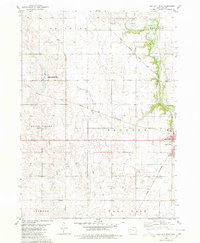
Odebolt anchor this agricultural landscape in Sac County, where the town’s eastern edge transitions into a grid of section lines and townships. The local geography is defined by a series of north-south drainage patterns, most notably the Boyer River and Odebolt Creek, which cut through the fertile till plains. For genealogists and local historians, the presence of numerous rural burial sites like Richland Cem, Salem Reform Cem, and Linton Cem provides specific points of interest across the townships of Richland, Clinton, Wheeler, and Levey. Industrial and transport history is represented by the diagonal line of the Chicago and North Western railroad, which historically dictated the flow of grain and goods through the region. Small-scale land use is further marked by a Gravel Pit near the river and a Rest Home on the outskirts of the primary settlement.
Find a feature on this map
17 named features on this map. Tap any name to fly to it.
Don’t see what you’re looking for? This feature index may not catch every label — zoom into the map to look around manually.
Map Details
Editions of this 1980 Odebolt East Map
This is the sole edition of this map. No revisions or reprints were ever made.
Other maps of this area

1954 · Fort Dodge
USGS Topo · 1:250,000

1957 · Fort Dodge
USGS Topo · 1:250,000

1958 · Fort Dodge
USGS Topo · 1:250,000

1971 · Kiron
USGS Topo · 1:24,000

1980 · Early
USGS Topo · 1:24,000

1980 · Lake View
USGS Topo · 1:24,000
1980 · Sac City West
USGS Topo · 1:24,000

1980 · Boyer
USGS Topo · 1:24,000
1980 · Vail NE
USGS Topo · 1:24,000
1980 · Odebolt West
USGS Topo · 1:24,000