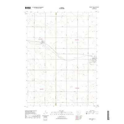
2018 Map of Odebolt West
USGS Topo · Published 2018About this map
Agricultural patterns and small-town street grids define this 2018 survey of the border between Sac and Ida Counties. The settlement of Arthur sits at the intersection of local roads like Pioneer Ave and the railroad-aligned corridor of Highway 175, while the western edge of Odebolt appears on the eastern margin, featuring a detailed street plan including Lincoln Ave and Hanson Blvd. The landscape is a network of section-line roads and winding waterways that drain the surrounding farmland, including Odebolt Creek and Hoskins Creek. Genealogists may find interest in the centrally located Hayes Cemetery, situated just off Country Highway M31. The mapping of the Solder River and various forks of Otter Creek further illustrates the drainage systems essential to this intensive farming region during the early 21st century.
Find a feature on this map
53 named features on this map. Tap any name to fly to it.
Don’t see what you’re looking for? This feature index may not catch every label — zoom into the map to look around manually.
Map Details
Editions of this 2018 Odebolt West Map
This is the sole edition of this map. No revisions or reprints were ever made.
Other maps of this area

1954 · Fort Dodge
USGS Topo · 1:250,000

1957 · Fort Dodge
USGS Topo · 1:250,000

1958 · Fort Dodge
USGS Topo · 1:250,000

1967 · Ida Grove
USGS Topo · 1:24,000

1967 · Ida Grove NW
USGS Topo · 1:24,000

1971 · Schleswig
USGS Topo · 1:24,000

1971 · Kiron
USGS Topo · 1:24,000

1980 · Odebolt East
USGS Topo · 1:24,000

1980 · Early
USGS Topo · 1:24,000

1980 · Boyer
USGS Topo · 1:24,000