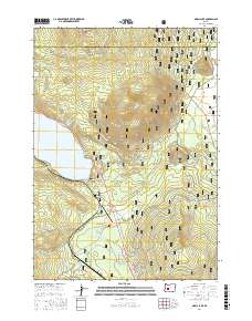
2017 Map of Odell Lake
USGS Topo · Published 2017About this map
Odell Lake serves as the centerpiece of this high-elevation landscape within the Deschutes National Forest. The 2017 survey reveals an intricate network of trails and forest roads that facilitate access to the surrounding volcanic peaks and alpine basins. The terrain is defined by prominent summits such as Maiden Peak and Royce Mtn, while water features like Maiden Lake and the Middle Rosary Lake chain occupy higher elevations.
Find a feature on this map
71 named features on this map. Tap any name to fly to it.
Don’t see what you’re looking for? This feature index may not catch every label — zoom into the map to look around manually.
Map Details
Editions of this 2017 Odell Lake Map
This is the sole edition of this map. No revisions or reprints were ever made.
Other maps of this area

1917 · Diamond Lake
USGS Topo · 1:125,000

1925 · Waldo Lake
USGS Topo · 1:125,000

1930 · Maiden Peak
USGS Topo · 1:125,000

1934 · Maiden Peak
USGS Topo · 1:125,000

1935 · Chemult
USGS Topo · 1:96,000

1941 · Chemult
USGS Topo · 1:125,000

1955 · Crescent
USGS Topo · 1:250,000

1956 · Waldo Lake
USGS Topo · 1:62,500

1956 · Summit Lake
USGS Topo · 1:62,500

1957 · Crescent
USGS Topo · 1:250,000