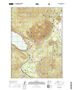
2020 Map of Odell Lake
USGS Topo · Published 2020About this map
Deschutes National Forest encompasses this high-elevation landscape, where the waters of Odell Lake and its numerous alpine tributaries dominate the terrain. This 2020 survey highlights a complex network of recreational infrastructure, from the Sunset Cove area to the Crescent Lake State Airport. The landscape is defined by its volcanic peaks and glacial features, including Maiden Peak and Maklaks Mtn, which rise above a series of smaller water bodies such as Maiden Lake and Fawn Lake. The drainage system is particularly intricate, featuring seasonal flows like Davis Lake Run and the protected Crescent Creek Wild and Scenic River. Grounded in modern resource management, the map identifies specific springs such as McCord Cabin Spring and a vast system of winter recreation trails including the Metolius-Windigo and the Maklaks Nordic Loop.
Find a feature on this map
55 named features on this map. Tap any name to fly to it.
Don’t see what you’re looking for? This feature index may not catch every label — zoom into the map to look around manually.
Map Details
Editions of this 2020 Odell Lake Map
This is the sole edition of this map. No revisions or reprints were ever made.
Other maps of this area

1917 · Diamond Lake
USGS Topo · 1:125,000

1925 · Waldo Lake
USGS Topo · 1:125,000

1930 · Maiden Peak
USGS Topo · 1:125,000

1934 · Maiden Peak
USGS Topo · 1:125,000

1935 · Chemult
USGS Topo · 1:96,000

1941 · Chemult
USGS Topo · 1:125,000

1955 · Crescent
USGS Topo · 1:250,000

1956 · Waldo Lake
USGS Topo · 1:62,500

1956 · Summit Lake
USGS Topo · 1:62,500

1957 · Crescent
USGS Topo · 1:250,000